


The biodiversity of Karnataka is often represented by depicting the Western Ghats and the tigers. While the importance of both cannot be undermined, there is also the 320-km-long coastline that the state boasts of, with its magnificent rivers, lagoons, bay areas, creeks, and beaches.
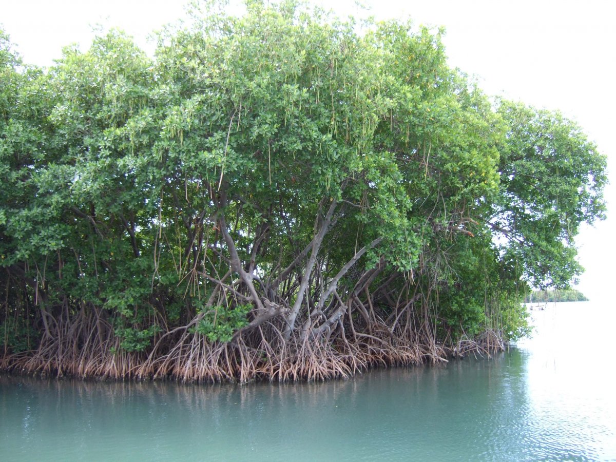
It is amidst this habitable conglomeration of saline waters from the seas and fresh water from the rivers, where the mangroves, the floating forests, thrive. These forests may not be as magnanimous as the more famous mangrove ecosystem of eastern India, the Sunderbans. However, the mangrove patches of Karnataka are a veritable spectacle, proving their worth through the ecological good they are bringing to the area, and the growing economic value.
Some of the best locations to find mangroves in Karnataka are Swarna, Sita, Kodi, Gangoli, Aghanashini and Kali rivers, and towards the mouth of Haladi-Chakra-Kollur rivers. As the rivers and several small rivulets originating from the Western Ghats make their way towards the Arabian Sea, the interplay of the salty sea water and the fresh river water comes into play. The habitat thus becomes congenial for mangrove swamps to develop with around 14 species of mangroves known to grow in the coastal zones of Karnataka.
The green wall
Things were, however, not the same a decade ago. The coasts of Karnataka did have mangroves, but they were sparse. The numbers were so insignificant that the Forest Survey of India missed recording the mangroves entirely while monitoring the ecological wealth of the state some years ago. Then began the ‘green wall’ project by the Forest Department in 2008. Deliberately, location after location on the coastal belt, the department and locals began planting the sturdy shrubs that are known world over as the natural coastal guards. According to the department statistics, more than 800 hectares in the estuarine area were brought under mangrove plantations this way. Now they have grown into full-fledged forests.

In a paper published in the journal Geophysics & Remote Sensing (2014), it was found that the planned plantation by the Karnataka Forest Department had indeed reaped rewards. Satellite imagery showed that the State had abundant mangrove systems spread over the coastal districts. While mangroves were declining in several parts of the world because of timber harvesting and pollution, they were in fact increasing in Karnataka.
The researchers, T V Ramachandra, professor with Indian Institute of Science, and Bharath Setturu found that at the confluence of four rivers, Aghanashini, Gangavali, Sharavati and Venkatapura with the Arabian Sea, there was a long stretch of mangroves locally known as the Kandla or Sundari. Udupi, Dakshina Kannada and Uttara Kannada also have a dense vegetation of mangroves that act as a green wall for the coasts. “The rejuvenation owes entirely to local conservation efforts, both by forest officials and communities, in reforestation and protection,” said Ramachandra, the lead author of the research paper.
Read More: World’s First Mangrove Zoo To Be Opened In West Bengal
Through a December 2016 study mapping the mangroves of Uttara Kannada district with the use of remote sensing imagery, by Energy and Wetlands Research Group, Centre of Ecological Sciences, a total of 1119.73 hectares of mangrove area and 1786.75 hectares potential area were registered.
Ecological & economical boost
In Aghanashini estuary, mangroves grew by four per cent between 1989 and 2010. In the Gangavali estuarine region, mangroves went up from 48.77% to 51.59% in the same time frame. The paper also estimated the value of an estuary as $19120 per hectare per year if all ‘goods and services’ are taken into account. The changes observed in the coastal areas, ecologically and economically, prove that this estimation is not wrong. Mangroves with their mesh of stilt roots appear like a plant with several fingers dipped in water and holding it in place. It is truly this elaborate root system that gives the mangroves the ability to not just remain steadfast in a largely loose ground underneath, but also withstand the daily rigours of rising and falling tide. Mangrove forests get flooded at least twice a day and this root system ensures that the force of the water is broken when it touches the shores. This prevents soil erosion, and also prevents coasts from severe storms and coastal damage.
“The mangroves grow in saline water. To shed salinity in their system, they shed leaves rapidly and give out new leaves that make them evergreen. The leaves fall into the water and become organic manure. To facilitate this process, trees have to ingest carbon rapidly and give out oxygen. This gives them the name carbon sink,” says V N Nayak, director, Sub-regional Science Centre at Karwar and member of the Karnataka state environmental report committee 2011. In simpler terms, the carbon storage capacity of one sq km of mangrove is equivalent to 50 sq km of tropical forest, thus providing much better way of containing carbon released to the atmosphere with relatively smaller area of a forest.
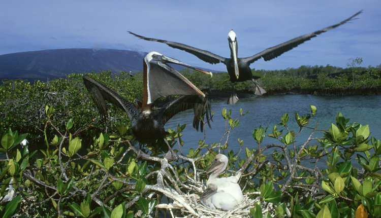
With global warming threatening the planet, this has huge implications on why even a single square kilometre of mangrove matters. For the aquatic organisms, mangroves are like nurturers, not just providing a safe haven for fish, oysters, crabs and other organisms, but acting as crèche and nurseries for them. The fishing industry is also heavily dependent on the mangroves for the same reason.
Read More: Oil Spill Creates Major Environment Crisis In Sunderbans
For Karnataka, what has come as an added surprise is the addition of another economic advantage due to the mangroves — the growing popularity of mangrove tourism. Mangrove tourists are those who love to spend their time near these ecosystems or take a boat ride just to catch a glimpse of the easy to spot avian and aquatic fauna in the area. Karwar and Ullal are a couple of spots that are giving people a chance to do just that.
Marine resources
A boat ride away from Sadashivgadh in Karwar is an island where the Forest Department had planted mangroves a few years back. The fishermen here call it the Devara Kadu (sacred groves), and they are happy that the department has taken efforts to restore the mangroves, which they themselves could not because of the logistics and finances involved. Through ancient wisdom, the locals knew that mangroves are crucial to safeguard them from the wrath of the seas as well as to provide abundant marine resources.
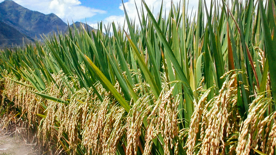
However, high degree of human impacts through centuries, which included reclamation of estuaries for rice and coconut cultivation, expansion of human settlements, shrimp farming, salt production, shell and sand mining, and cutting for fuel and timber degraded the mangrove ecosystem throughout Karnataka. If the tides have turned now, it is hopefully bringing a better understanding to ascertain that the floating forests continue to guard and bring prosperity to the region.
Read More: How Mumbai Mangroves Save The City Everyday
This article by Atula Gupta was originally published in Deccan Herald